


Boulder County Trails
The official GPS trail map for Boulder County Parks and Open Space. Let your iPhone find you on the trail and show you your options!
*** Tip ***
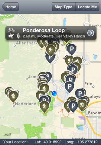
Zoom around the map before heading to your destination. This will cache and save the map so you can use it even when you aren’t connected to the internet.
*** Features***
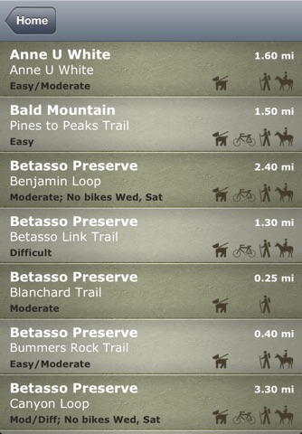
-Trail Length
-Trail Difficulty
-Parking Locations
-Allowed Uses (dogs, bikes and horses)
-Locate Me (see where you are on the trail)
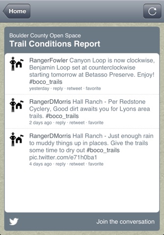
-Trail Conditions (as reported on Twitter; requires internet connection)
-Satellite Map (see the landscape in incredible photographic detail)
***Notes***
-Locate Me works best on iPhone 4, iPhone 4S and iPhone 5.
-This application does not include other local agency trails such as City of Boulder or United States Forest Service trails.